
Monsoon's Winter Precipitation Forecast
Today is friggin’ cold. Any damned fool who has stepped outside can tell that. In fact, it’s going to struggle to get to 30 this afternoon, and given the blustery conditions, wind chills will be in the teens for much of the day. Low tonight: 18.
Saturday looks a bit warmer and still breezy, getting up to a balmy 35, then down to 22 overnight. Mostly sunny skies throughout the day will give way to increasing clouds late.
On Sunday we’ll see light sleet and snow developing by 10am or so, changing first to freezing rain (meaning that it may freeze to surfaces), then changing by early afternoon to plain old rain. The rain will continue through the nighttime, tapering overnight. Expect highs in the low 40s and a low Sunday night in the mid 30s.
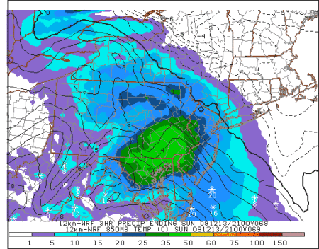
Partly sunny and a bit milder on Monday with a high in the mid 40s.
Chance of cancellation Monday: 5%
Chance of delay Monday: 10%
The next chance of winter precipitation is on Tuesday into Wednesday, when a strong cold front and an area of moisture will coincide. But as of now, this doesn’t look like anything to get a jazzed up about.
After that, the next good chance of snow is around the 22nd to the 23rd.
Stay tuned for updates!