
Monsoon's December Nor'easter Forecast
Well, well. A December Nor’easter. I’ll be damned.
Long term forecast is in the works, but what you really want to hear about is this weekend’s storm, so here goes…
Snow begins early Saturday morning (perhaps before dawn), rather light at first but intensifying after noon. Heaviest snow will be in the afternoon and through the evening. Snow will taper off overnight, though there’s a chance of a few light snow showers lingering into Sunday morning.
Temperatures will hold in the mid 20s for the entirety of this storm, so there will be no mixing and we’ll get good “fluff” (or snow ratios) here. There are also signs the system will slow down once it gets here, potentially increasing snow totals further. Watch for blowing and drifting as winds kick up in the afternoon and evening on Saturday.
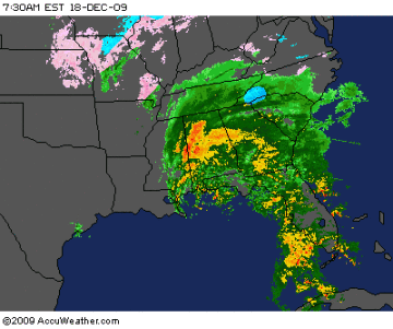
Caveat: storms like this are notoriously difficult to predict, since we’re depending on the low to bomb out off the coast and drive the moisture into our area. A shift of 20-30 miles in track could affect the snow totals—and who gets hit—significantly. Here’s a look at the impressive area of moisture as it churns through the south…
But…no guts, no glory, so I won’t hedge. Here are my predicted storm totals:
Philadelphia and the immediate suburbs, northern Maryland and Delaware, and border areas of south Jersey: 10-14 inches; more in isolated areas
Lancaster, York, and Berks Counties, Lehigh Valley and vicinity: 6-10 inches; more in isolated areas
Lebanon, Dauphin and Cumberland Counties and the central portion of PA: 4-6 inches.
Stay tuned for tweakage and updates as they become necessary…