
Forecast: Thursday 1/21 - Friday 1/22 Event
People,
Here is my take on the Thursday night-Friday morning event…
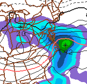
The system is not all that well-organized and is not terribly moisture-laden. And there are some forecast models that suggest the system will actually pass to our south, giving us nary a damned thing. But hedge will I not. Here is what I think is going to happen:
Light snow showers develop sometime between 10pm and midnight. Snow showers become somewhat steadier overnight, accumulating perhaps as much as an inch.
Freezing rain and/or sleet mix in toward the morning commute—in the range of 3am to 9am—producing a very slippery half-inch coating of ice on top of the already-fallen snow.
[Quick weather review: freezing rain starts as snow in the upper atmosphere, then melts to liquid form in warmer air closer to the ground. It hits the ground as rain, but when the surface temperature is below 32 degrees, it freezes to the surface, creating a dangerous sheet of ice. On the other hand, sleet also starts as snow in the upper atmosphere, then melts to liquid form, but then refreezes before hitting the ground as ice pellets. Good rule of thumb: if you see it bouncing off the ground, it’s sleet; if it looks like rain but is creating a glazy coating on the ground, it’s freezing rain. They both suck for drivers, but freezing rain tends to be the more dangerous of the two.]
Temperatures will not get above freezing until toward noon, with a high getting to just the mid 30s in the afternoon. Expect tapering precipitation—rain, mixed with a few flurries and snow showers—ending through the afternoon.
We’re in the clear as temperatures get milder on Saturday. Then on Sunday, temperatures will rise into the upper 40s and some heavy rain moves through Sunday evening into Monday. Since the mercury will stay well above freezing, even overnight, this will not cause any driving headaches (other than from those people who seem to have an instantaneous loss of their faculties when driving in the rain), and it will cause no delays or cancellations.
…which brings me to the predictions for Friday.
Chance of school cancellation Friday: 40%
Chance of school delay Friday: 75%
Predictions are subject to change. If my forecast evolves into something significantly different from what appears above (either in time of arrival, or in precipitation types, or in delay chances), I will send out an update.