
Blown forecast. I've gotta do a better job.
Obviously, the storm did a heckuva job yesterday.
*ahem*
Stayed east when we thought it would come west. My hat's off to the Nor'easter for giving 110% and really switching it up on us.
*hep-hrrrm*
I mean, we did some nice things in there.
*mmmmmmgch*
The storm did dump snow in some areas, just not where we thought. Freehold had 13 inches, and parts of Connecticut got 8-10 inches.
*sighhhh-cough!*
But I said it was gonna give us some snow, and I take full responsibility for that. All we saw were a few squalls and some wind later on. And that's unacceptable. That's on me.
*claghhh*
Bottom line is, I've gotta do a better job. I've gotta put the forecast models in better positions.
*hack!*
This is fixable. A forecast here and a forecast there, and pretty soon we're back in it.
*ghghghghgm*
We're all in this together. A today we're all gonna be blown: winds will be in the 15-25mph range with gusts as high as 35mph. We'll know more about that tomorrow, since that is when we'll be able to look back and say, this is what happened. Because hindsight's 20/20, and we wanna play aggressive, emotional meteorology.
*mghaaaa*
Nicer weather is ahead. Sunny Friday with a high of 55. Sunny Saturday with a high of 62. Sunny Sunday with a high of 65. And mostly sunny on Monday with a high of 66. Next chance of rain is on Tuesday, so we'll see what happens with that. Thanksgiving week looks like a rainy mess, but we're not gonna get caught looking ahead.
*Hm-uhm...hm-uhm!*
Time's yours.

A churning, lashing beast.
But enough about your mom.

I've seen Hurricane Sandy called the Perfect Storm, a Frankenstorm, and Sandy Cane (?), but the above phrase provides a description that is more apt than wry.
The storm is coming, and it will hit us. Precise track and landfall will be determined by a variety of factors, but here is what I think is going to happen:
Sandy will make landfall in the Delmarva Peninsula/South Jersey area on Monday afternoon, but we will begin to see some rain from this system by Sunday afternoon, and some winds (10-20mph), but neither will be heavy.
Barometric pressures with this event could reach historic lows.
On Monday, the winds and rain get heavier, and by Monday evening (6-8pm) we'll see tropical storm conditions moving in to the area. (That means sustained winds in the 35-45mph range and gusts of 60-70mph, with heavy rain.) These conditions will persist into Tuesday night and perhaps even into Wednesday morning. Rain from Sandy will linger into Thursday.
A "Frequently Asked Questions" section follows.
What complications are likely to develop?
High winds will lead to widespread damage (from fallen trees, branches and other projectiles) in the form of broken windows and the like
Widespread power outages, most seriously on Monday into Tuesday, potentially lasting for several days or even a week - mostly due to fallen trees and high winds
Storm surges of five or more feet - not only coastally, but 20-30 miles inland as well. It's a full moon Monday, so tides will be high to begin with
Rainfall in the amount of 5-6 inches will lead to swollen waterways, wet basements, and widespread inland flooding
Widespread flight delays or cancellations, as the storm will impact transportation hubs like D.C., NYC, and Philadelphia
Is this storm likely to cause school cancellations, delays, and the like?
Yes. I foresee an early dismissal on Monday and closure Tuesday and Wednesday.
How should we prepare?
Buy canned food and bottled water - things that will keep in unrefrigerated conditions.
Make sure you have plenty of batteries on hand to power flashlights and radios.
Bring in outdoor furniture, garden tools, toys, garbage cans, and landscape decorations, removing anything that could become a projectile in high winds.
Don't drive through a water-covered road, as it's usually impossible to ascertain the depth of the water. After every storm of this nature, there's footage of some poor schmuck being rescued from floodwaters after he drove into a flooded section of roadway and his car stalled out. Don't be that schmuck.
Watch out for tornadoes, as tropical storms can often produce them.
During periods of extremely high winds, stay on the first floor and away from windows.
Don't mess around with downed power lines and get yourself electrocuted.
Don't try to cuddle a panda, no matter how cute it might look. Learned that one the hard way.
Stay tuned for updates this weekend as the storm comes into clearer focus...
Sandy: The Perfect Storm?
My good people,
You know that I spurn the hyperbolic alarmism of the major weather outlets (*cough* AccuWeather *cough* Hurricane Schwartz) as canards designed to drive up ratings and incite frenzied consumption of bread, milk, duct tape, bottled water, and bacon. (Gotta have bacon.)
But the system that is now Hurricane Sandy--churning through Jamaica right now, bearing down on Cuba, heading north toward the Bahamas by daybreak Thursday--is likely to deliver us dangerous, disruptive weather.
For reals.
Rather than bore you with talk of convection and trough depth and model solutions, I will simply note that there is disagreement in the meteorological community (and among forecast models) about the precise track Sandy will follow, which determines whether we get a direct hit or a glancing blow.
Here's what I think is the most likely development of this system:
Sandy makes landfall in the New Jersey-New York-Connecticut area on Monday afternoon. The result is damaging winds for people as far inland as central Pennsylvania, as well as major coastal and inland flooding. (There was some talk of snow with this system. Aside from extremely high elevations in the Appalachians, I don't see it. This is just heavy rain.)
So here's the forecast for the next 10 days or so, with updates forthcoming as I get a surer handle on Sandy:
Thursday 10/25: A foggy morning gives way to a partly sunny day. Still warmer than normal with highs in the lower 70s and lows in the upper 50s. Maybe a bit of drizzle/mist and fog late at night.
Friday 10/26: Scattered fog again, and again we'll see highs in the lower 70s--though clouds will dominate throughout the day. A cloudy night with lows in the mid 50s.
Saturday 10/27: Sun mixed with clouds and breezy. Highs in the upper 60s, lows in the lower 50s. Maybe a sprinkle or two during the day, but mostly dry.
Sunday 10/28: Noticeably cooler with highs only reaching the upper 50s. Breezy and overcast with showers possible during the day, then rain more likely at night. Lows in the mid 40s.
Monday 10/29: Rainy and windy and raw and foul. Temperatures holding steady in the low to mid 50s for much of the day and night.
Tuesday 10/30: Like Monday, but cooler. Still rainy and windy and nasty. Highs struggling to reach 50; lows in the upper 30s.

Gratuitous, inexplicable picture of David Hasselhoff.
Wednesday 10/31: Rainy, again. Tapering toward evening. Windy. Highs around 50, lows in the upper 30s.
Thursday 11/1: Partly sunny and colder. Highs only in the mid 40s. Lows in the mid 30s. Still rather windy.
Friday 11/2: Partly cloudy with lingering breezes. Highs in the mid 40s, lows in the low 30s.
Saturday 11/3: Variable cloudiness. Highs in the low 50s, lows in the upper 30s.
Bottom line: Next week is going to be miserable, and possibly dangerous.
Feisty Pumpkin, good. Frosty Pumpkins, bad.
My most excellent good friends:
It has been many days since I last posted, many of them unpleasantly warm. Now it is autumn, but the next couple of days are actually going to feel more like early winter. Not to fear, though - we'll return to normal conditions for this time of year (highs in the mid 60s, lows in the mid 40s) soon enough...
 Today will be chilly and breezy with plenty of sunshine and highs in the upper 50s. I expect freeze warnings to be issued for much of the area for the overnight period. Temperatures will dip into the low 30s (freezing is 32, for the uninitiated) toward early Saturday morning. So bring in your mums and pumpkins; while everyone likes a feisty pumpkin, and a pumpkin pie with frosting is divine, a frosty pumpkin can ruin your weekend.
Saturday will be brilliantly sunny and continued rather cool with highs in the upper 50s, but overnight lows getting only into the upper 30s.
Sunday looks gorgeous with highs approaching (and in some places, exceeding) 70 but a nice fall breeze. Clouds will increase toward evening, but I don't think we'll see any showers until Monday. Low on Sunday night will be in the low 50s.
Monday morning: chance of a shower or two, but no big deal. Highs in the mid 70s, lows near 50.
Clouds mixed with sun on Tuesday with seasonable temperatures: highs in the mid 60s, lows in the mid 40s. The same holds for Wednesday and Thursday as well.
Friday could bring some showers, which may linger into the first part of the weekend. Speaking of which...
 Next weekend looks decent, but fairly cloudy and cool. Highs just above 60 on Saturday, just below 60 on Sunday.
The following week (beginning with Monday 10/22) is when we're going to see some chilly, raw, and pluvious days. Highs will struggle to reach 50 most days that week, and there will be rain much of the time...
I see no chance of snow in the next month (and notwithstanding last year's freak October snowstorm, that is as it should be).
Keep it real. Always.
End of the school year forecast
It's the end of the school year. No farewell speeches that approach the depravity and--let's face it--brilliance of Ignacio Boondoggle's. Yet.
Tomorrow (Friday 5/18) is Imagine Day, and for the first time in recent memory, there is no threat of rain. In addition, the American Studies team over at Muhlenberg is taking students on a whirlwind day tour of Washington, D.C. on Sunday, during which the group will visit 14 museums, 19 memorials, and of course, the Hard Rock Café.
And folks are beginning to look toward the Memorial Day weekend for outdoor plans. For the first time, Mrs. Monsoon and I can visit the Adamstown Community Days carnival and then leave, rather than living across the street from it, breathing a nauseating mixture of generator fumes, funnel cake grease, and carnie sweat for several days.
So here is the forecast.
Friday 5/18: really, really nice and sunny. Temperatures will be in the low 70s with brilliant sunshine, low humidity, and very light breezes for the duration of our time outside (roughly noon to 3pm). High Friday will be 75, low will be 44.
Saturday 5/19: expect a high of 82 and a low of 55. Plenty of sunshine and a bit warmer than Friday.
Sunday 5/20: sunny to start; increasing cloudiness throughout the day, but no threat of precipitation until Monday. High 79, low 58.
The Washington, D.C. trip will be spending the entire day in the nation's capital, so here's what to expect:
9am, 66 degrees and partly cloudy with a very light northwesterly breeze.
11am, 72 degrees and the same conditions as 9am.
1pm, 76 degrees and the same conditions as 9am.
3pm, 78 degrees and increasing cloudiness, as breezes shift, coming from the northeast.
5pm, 79 degrees and same conditions as 3pm.
7pm, 75 degrees and same conditions as 3pm.
9pm, 70 degrees and a very small chance of a passing shower.
Monday 5/21: clouds predominate; chance of a thunderstorm, especially in the afternoon, with a high of 76. Clouds persist in the overnight hours, with a low of 59.
Tuesday 5/22: very similar to Monday; thunderstorms possible in the afternoon, then an added chance of showers in the evening. The high reaches 78, the low reaches 57.

Little-known Monsoon fact: we have a turtle living with us. His name is Chester, he is a red-eared slider, and he looks like this. He's been a part of our family for 16 years!Wednesday 5/23: clouds mixed with sun; early showers. High 77, low 57. (Happy World Turtle Day!)
Thursday 5/24: partly sunny and breezy as tumultuous weather gives way to settled high pressure. High 74, low 52.
Friday 5/25: for the unofficial kickoff to Memorial Day weekend, expect a continuation of Thursday's weather: partly sunny and breezy with highs in the mid 70s.
Saturday 5/26: partly cloudy and quite a bit warmer to start. High 85. Rain, I'm afraid, will move in--especially in the evening and overnight. Low 66.
Sunday 5/27: sunny and very warm, with increased humidity. High 91. (We may even challenge the record of 93 set in 1914.) Low 68.
Monday 5/28: sunny and continued warm, but with breezes and decreased humidity mitigating the heat. High 89, low 61.
Tuesday 5/29: sunny, breezy, and seasonably warm. High 81, low 55.
Wednesday 5/30: sunny and splendiferous. High 76, low 52.
Thursday 5/31: sunny and enchantingly gorgeous weather. High 74, low 50.
June: begins seasonably warmish (highs in the low to mid 80s) then we'll see record-challenging heat by mid-month.
Happy Jenkins' Ear Day!

“Fuck’s sake, Jenkins. We get it, your ear’s off and you’re bloody furious. But we were just going to sit down to lunch.”
...and also Winston Churchill Day. April 9th. The latter commemorates the day Churchill was posthumously named an honorary American citizen; the former refers to a mid-18th century war between Britain and Spain that involved British mercantilist Robert Jenkins exhibiting his ear (which had been severed by a Spaniard) before Parliament. Seriously. Look it up.
And we're in the midst of National Grilled Cheese Sandwich Month, National Pecan Month, Cranberries and Gooseberries Month, Brussels Sprouts and Cabbage Month, Tomatillo and Asian Pear Month--and National IBS (Irritable Bowel Syndrome) month. Those celebrations are at cross purposes, it would seem.
It's also International Twit Award Month (send nominations to me via email) and National STDs (Sexually Transmitted Diseases) Month (send one to me at ... never mind.)
Anywho, the weather. It's been really dry and windy over the last few days, thanks to a high pressure system squeezed in over our area. We'll see rain and chilliness over the next week, followed by a return to warmth...
Monday 4/9: We've got another Red Flag Warning for today, as extremely low relative humidity levels coupled with high winds produce ideal conditions for wildfires. Winds could gust toward 50mph. High of 63. Tonight we'll see windy conditions persist (though the wind will diminish), a continued partly cloudy skies. Low of 35.
Tuesday 4/10: Happy National Farm Animals Day! Today will be mostly cloudy, breezy, and cooler with a high of 54. A couple of stray light showers are possible. Overnight low of 44.
Wednesday 4/11: It's National Pet Day! Again, we'll see mostly cloudy skies, breezy conditions, and cooler temperatures. Scattered showers may again move through in some places, but it won't be a "washout." High 52, low 45.
Thursday 4/12: Celebrate DEAR (Drop Everything and Read) Day by walking in to a grocery store, loading up your arms full of celery and tomato soup and cat food, walking to the register, letting it all crash to the floor--then calmly take out a book, take a seat, and read. I mean, that's what I am going to do. You guys celebrate in your own ways. So the weather will be continued cool and breezy, but with more sunshine. And no rain. High 56, low 42.
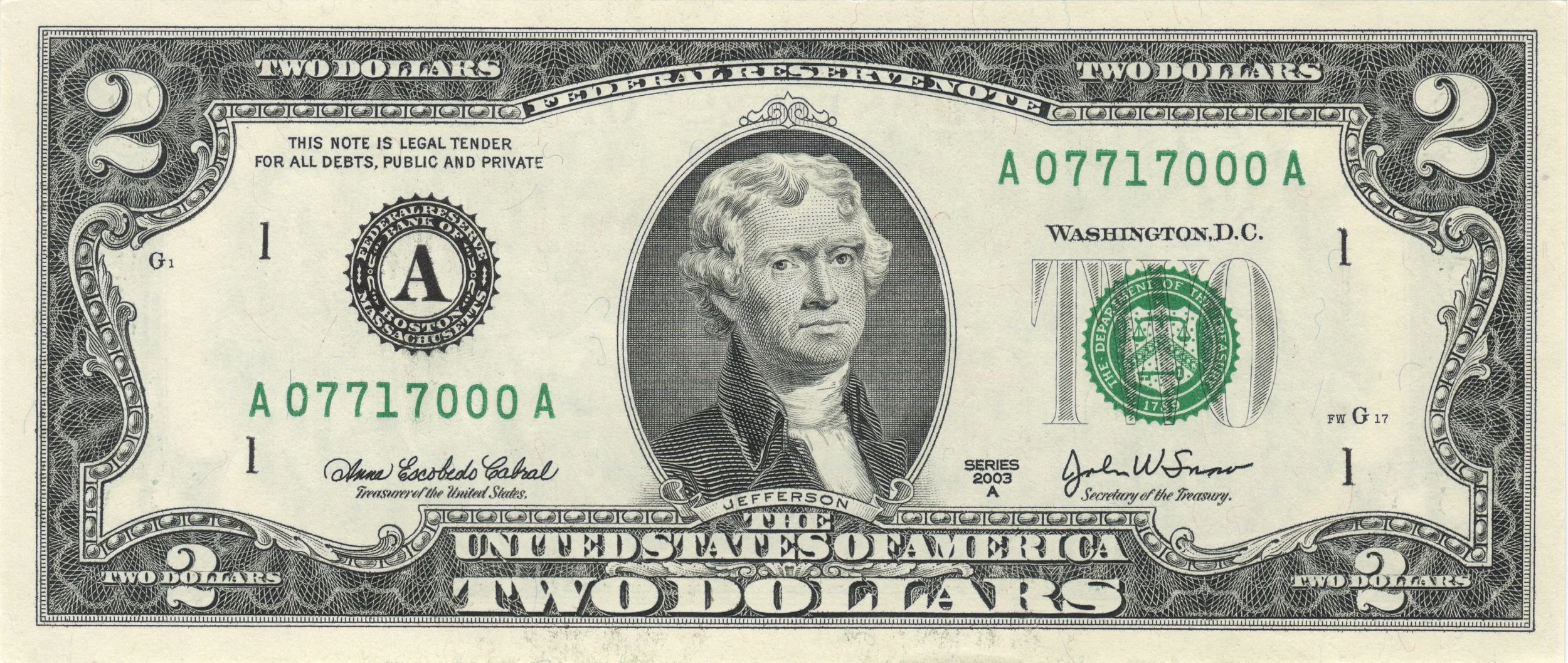
Friday 4/13: It's Thomas Jefferson Day, so go out and father a child with your -- no, nope, that's inappropriate. Better yet, buy something for $2.05 and pay with a $2 bill and a nickel, both of which feature Jefferson's likeness. And the weather will be sunny and milder. High 62, low 41.
Saturday 4/14: Dictionary Day! To celebrate, go find an actual dictionary (not one on a computer or your smart phone, but an actual dictionary with pages you can flip through). Open to a random page. Close your eyes and pick a word. Use that word in conversation at least five times throughout the day. The weather will be partly sunny with a stray thunderstorm possible. Look for highs about 66 and lows in the upper 40s.
Sunday 4/15: In addition to being the traditional Income Tax Day, it's also National That Sucks Day, which seems to be an appropriate, if inelegantly stated, sentiment. Today will be warmish with a high of 69, and perhaps some a bit of a shower in the afternoon. Overnight low will be in the mid to upper 50s.
Next week: Be sure to mark the redundantly named National Haiku Poetry Day (April 17th), Husband Appreciation Day (April 20th), and, of course, Record Store Day (April 21st). Next week's weather looks unseasonably warm to start (highs in the 70s Monday through Wednesday), then after a little hiccup, we'll see even warmer temps for the end of the week. The following weekend (the 21st and 22nd) will see highs in the upper 70s with brilliant sunshine...
MLK Day / forecast
Today is Martin Luther King Day. Less well-known than his civil rights work is Dr. King’s anti-war stance, which emerged strongly in the final year of his life. This pacifist epiphany occurred when "I knew that I could never again raise my voice against the violence of the oppressed in the ghettos without having first spoken clearly to the greatest purveyor of violence in the world today, my own government." On April 4, 1967, Dr. King delivered an address entitled “A Time to Break Silence.” It included the following words:
 "Now, it should be incandescently clear that no one who has any concern for the integrity and life of America today can ignore the present war. If America's soul becomes totally poisoned, part of the autopsy must read: Vietnam. It can never be saved so long as it destroys the deepest hopes of men the world over. So it is that those of us who are yet determined that America will be are led down the path of protest and dissent, working for the health of our land."
Exactly one year later, he was assassinated in Memphis. James Earl Ray confessed to the murder, but theories persist that Dr. King’s nascent anti-war agitation made him a target of those who were waging that unpopular war.
Anywho. No way to smoothly transition from MLK to the weather.
So here’s what to expect overnight:
Monday will be mostly sunny and breezy today with a high only in the mid 30s.
Rain begins overnight – by 11 or 12. Sleet and freezing rain mix in throughout the early overnight hours, then changes to all rain by 4 or 5am. We could see a small accumulation of ice on the roads and sidewalks overnight—so use caution when driving—but this will be washed away by morning. Rain then tapers by late Tuesday afternoon. (The temperatures will actually rise overnight, from 32 at 11pm to 38 by 9am. Problem is, there’s no classic “trough” to trap to cold air into our area.) Still, we could see a bit of the slipperiness hang around into the morning commute, so I’ll call it:
40% chance of school delays.
15% chance of school cancellation.
The high temperature will actually reach a (comparatively) balmy 46.
Wednesday looks partly sunny, quite windy, and colder, with a high of 36 and an overnight low in the upper teens.
Thursday and Friday look like more of the same, albeit with diminishing winds. (Slight chance of snow showers Thursday night into Friday. No big whoop.)
The weekend looks milder with highs in the low 50s, but also the chance of some (rain) showers.
Snow? Ice? Wintry weather? I see nothing terribly promising through to the end of January.
Of course, all that can change rapidly, so stay tuned…
Monsoon's Winter 2011-12 Forecast
It's time.
Meteorological winter (December through February) is almost upon us, and it is time for me to cogitate, calculate, speculate, and prognosticate. And depending on the quality of the forecast, you all will either flagellate or adulate me.
But farewell it, for I will use no art.
 (Wait, you might say: hasn't winter already begun? Didn't we have 8 to 10 inches of wintry wetness plopped on our pumpkins and mums and harvest milieus at the end of October? Yes, we did; the picture at right, taken in front of our house, attests to it. But it was an anomaly, a climatological pink moon, and it will not figure in my figuring here.)
Over all, expect a stormy winter of merciless vicissitudes, both in terms of temperature and barometric pressure. There will be a few hits and lots of near-misses. Tracking it all will be fun. (I mean that. I know sarcasm is my true medium, but I really mean that I find weather-watching and forecasting to be enjoyable.)
 December 2011: this month will start with temperatures at or near normal (highs in the upper 40s, lows at or just below freezing), then around the 7th or 8th, we'll see a precipitous drop-off, with highs only in the upper 30s--and perhaps even a bit of snowfall. By mid-month we'll be back to normal, and expect a stormy, frigid end of December. Temperatures a couple of degrees below normal over all. Total snowfall: 4-6 inches. School disruptions: no delays, no cancellations.
 January 2012: the end-of-year turbulence will continue into January, when we'll see some abnormally cold temperatures. The typical January thaw will follow around the third week of the month, but it will be short-lived. Temperatures 3 degrees below normal over all. Total snowfall: 10-12 inches. School disruptions: 4 delays, 2 cancellations.
 February 2012: Some snow early, including a potentially major storm. Then we'll see a warm-up by mid-month, and temperatures will actually be a few degrees above normal for the month. Total snowfall: 8-10 inches. School disruptions: 2 delays, 1 cancellation.
 March 2012: rainy to start, with a bit of snow mixed in early in the month, but nothing major. Temperatures will be a degree above normal. Total snowfall: nothing significant. School disruptions: 1 delay, no cancellations.
In all, I expect we'll get at or just below the normal snowfall for this region, 25 inches. We'll have 7 delays and 3 cancellations.
And I am looking forward to casting fore for you fine people, all winter long...