
Quick one about Sunday and next week.
On Sunday we'll have a bit of snow. Not a lot. An inch or two at most.
 Multiple hues of dark denim, multiple button malfunction, black leather gleaming, sprig of chest-fur peeks. His name is David Michael Hasselhoff, and you have seen more pictures of him than you ever imagined you would in your entire lifetime.Begins as flurries by noon. Then some steadier periods of light snow in the afternoon. 3pm-7pm is the period during which some slippery-roadway-creating snow will most likely fall. Flurries end by about 11pm. Most places will see only about an inch. Someone, somewhere might get as much as 2.2 inches. That's it, though.
Monday will be partly sunny and cold. A delay is not likely, but not out of the realm of possibility. High 28. Then it gets bitterly cold again overnight into Tuesday, falling to 8 (with breezy conditions making it feel like 0).
It's been some winter when single digits make us say, "Big frickage. Wake me up when it gets below zero. In fact, you know what? Don't wake me up 'til late March. I will hibernate, like an actual bear, for the next six weeks."
Yes, frickage. I just made it up.
Chance of delay Monday, 30%
Chance of cancellation Monday, 11%
Tuesday is cold too. Clouds breaking. High of 25. Single digits again at night. Yawn.
Partly cloudy and not quite as cold on Wednesday. High of 33!
Snow still looks likely for the Wednesday night-to-Thursday evening period. On Monday, I will have a better idea on that storm, and I will tell you fine people all about it.
Chance of early dismissal Wednesday, 23%
Chance of delay Thursday, 70%
Chance of cancellation Thursday, 55%
And then milder for the middle of the month and beyond.
Stay tuned for updates!
Weekend fizzles; next week action?
As of this morning, there were still a couple hundred thousand people with no power from Wednesday's ice storm, so I hope everyone is safe and warm...
Keep on the lookout for black ice tonight as the temperature gets down to about 12.
On to the much-discussed weekend. To be concise, we are lacking the ingredients we would need for a major snowfall. Saturday will be cold (high of 31) and mostly cloudy with a few snow showers likely in the late afternoon/evening range. Expect a mere coating from this action, but no appreciable accumulation. (This will be a "nuisance event," though, meaning that you should check the Doppler before you go out to see if you're likely to encounter snow. Remember: it doesn't take much snow at all to make the roads slippery, and even less to make people forget how to drive.)
On Sunday morning, expect a bit more snow. We could have light accumulations in some areas (an inch or two at most), but the majority of people will just have snow showers, tapering to flurries in the afternoon.
 Der Graupel-Hassel-Hund (literally, sky fruit hirsute dog) poses in 1989 with his single "Looking for Freedom." Just take a moment to take a tall drink of Hoff: the chest fur, the ripped jeans, the superfluous leather. How is he not a bigger star? you wonder. He is the biggest star, I correct you.Monday looks sunny, windy, and cold (high 28); Tuesday will be even colder with a high of only 24. Overnight lows for both days will be in the lower teens.
The Wednesday afternoon through Thursday morning time frame is looking provocative for a winter storm. Right now I'd say this is looking likely, and it's setting up for an early dismissal Wednesday and a day off Thursday.
But! I think this coming week will bring our LAST SNOW DAY OF THE SCHOOL YEAR!! I think.
After that, things warm up a bit: highs in the 40s on Friday, Saturday, and Sunday. And the 50s by the end of the following week (2/19, 2/20, 2/21)!
Stay tuned for updates...
Wednesday afternoon update
Alright. Some northern areas (Sussex County, NJ; Carbon and Monroe Counties in PA) got 8-10 inches of snowfall out of this. For most of the rest of us, we got relatively little snowfall (and inch or two at most), but significant icing: one-quarter to one-third of an inch of ice accretion reported in much of southeastern Pennsylvania. Also heard reports of lightning(!) and heavy snow banding in upstate NJ and NY. Demonic bird-lizards have been spotted running through the streets of Tredyffrin Township. (Alright, I made that last one up. I just wanted an excuse to reference Tredyffrin. I love that name.)
Lots of trees/lines down. Power outages in SE PA are over 600,000 now. (Chester County got especially badly hit: more than 80 percent of customers there are without power.) As of 1:30, precipitation was pretty much over for most of us.
 This morning, in West Chester.Winds are pretty calm now, but will pick up somewhat (10-15mph out of the northwest) this evening and overnight. So I'm worried about the trees. They have all this wet snow on them, and the branches/limbs have a coating of ice, so when a stiff breeze comes by, they're just going to be like, eff it. Falling on power lines, across roads, that sort of thing.
As a result, I see the power outage numbers going down this afternoon, but rising again overnight.
According to reports I have received, the roads are generally OK. Main roads are just wet; secondary roads are slushy. Some slick spots. I am receiving reports of some minor flooding on roadways (since the drains are dammed with ice), so watch out for that. Some refreezing overnight.
Temperatures will hold steady in the mid 30s today, but after sunset (about 5:30), expect temperatures to fall quickly. 25 by midnight; upper teens around Thursday morning's school commute. Temperatures won't rise above the mid 20s during the day Thursday; same thing Friday.
Chance of delay Thursday, 75%
Chance of cancellation Thursday, 40%
Chance of delay Friday, 35%
Chance of cancellation Friday, 15%
Saturday looks cloudy and cold but, I think, not snowy. Storm misses us to the south.
During the first half of Sunday we could get a few inches of snow, but it clears by evening. Maybe a delay Monday, but that's it.
And beyond that?
*sighhhhh*
We could get some more wintry precipitation on Wednesday (snowstorm) and Thursday (ice storm).
And then by next weekend (2/15) we see milder temperatures.
Stay tuned!
Are we going to have off tomorrow?
Snow day crew,
If I had a nickel for every time I've heard that already today, I'd have twenty-five cents. If I had a nickel for every time I'm going to hear that today, I'd have forty-five million dollars.
The math is solid. Don't hassle me.
For tonight's storm, this is my latest thinking:
Snow begins by 9 or 10pm tonight, falling lightly at first, then heavier after midnight. Snow will mix with sleet toward morning (say, 6am) but I still think this is going to be mostly a snow event. Even if the precipitation changes to rain (which it may, briefly), the rain will freeze on surfaces and make already-treacherous secondary roads impassable. If you try to walk, you will have an ass-meeting with the sidewalk.
 Look at the lines. Isn't it pretty? Wind.Snowfall totals are being overblown by some media outlets, I think. Other outlets say 4-8" for Lancaster and the western suburbs of Philly, 6-10" for Berks, Allentown, Pottsville, some of North Jersey, and NYC, and 8-12" in northeastern Pennsylvania (Scranton and the Poconos and whatnot) as well as extreme North Jersey.
I think these amounts are a bit high. What I'd say is:
2-4 inches in Philly, South Jersey, Chester County, Lancaster County, with .4 inch ice accumulation
4-6 inches in Berks, Allentown, NYC, North Jersey, with .2 inch ice accumulation
6-10 inches in northeastern Pennsylvania (with isolated areas getting a foot or more); no appreciable ice accumulation
But really, at this point, do snow totals mean a whole lot? I mean, most of us just got 8-10 inches of snow. Does it really matter if there are 4 inches or 8 inches on top of that? Unless you are insane (I'm looking at you, Dreads), you are probably very ready for winter to be over.
Back to business. Snow and/or a foul mixture falls throughout Wednesday morning, ending by about 1pm. However, unlike in a typical mixed-precipitation event, temperatures will only rise a degree or two above freezing before plummeting back into the lower 20s (and breezy) overnight.
Impacts:
Areas in the first region listed above (Philly, Chester County, etc.) will see widespread icing and power outages. Less so in the second region (Berks, Allentown, etc.), but the threat is still there.
School closing:
Chance of delay Wednesday, 85%
Chance of cancellation Wednesday, 70%
Chance of early dismissal Wednesday, 0.52%
Chance of delay Thursday, 60%
Chance of cancellation Thursday, 20%
Highs on Thursday and Friday will be in the upper 20s, but it will be mostly sunny, so there's that.
The next system is one that continues to bear watching. It appears that it will affect our area in the late-Saturday-night-to-Monday-afternoon time frame. And it looks like it could be a big storm.
Stay tuned for updates!
Chubby snow, and then a mess Tuesday into Wednesday.
It was still snow here as of 2pm, but will taper and end by mid-afternoon. Snow totals I predicted were a little low. Be sure to email me your measurements (your snow measurements - keep it clean) so I can pass them along to the people.
Temperatures will drop into the 20s this evening, teens overnight. During tomorrow morning's commute, expect temperatures to be around 20. There will be some issues with freezing, and with roads that still haven't been cleared, but given that the snow will end by mid-afternoon, I don't see a cancellation tomorrow. It's a classic two-hour delay scenario.
Chance of delay Tuesday, 70%
Chance of cancellation Tuesday, 40%
Then the Tuesday night to Wednesday storm. Here's what I see:
Precipitation begins as snow Tuesday evening around 8 or 9pm. Snow accumulates 2-4 inches, then mixes with (and changes to) sleet and freezing rain by 9am Wednesday. Models are trending colder for this event, so it appears it will be mostly snow. That is good thing, actually, as a prolonged period of icing could lead to widespread power outages and all sorts of nastiness. Ends as rain early Wednesday afternoon.
 His name is David Hasselhoff, and he can sing.Rain/snow lines, temperatures in the upper atmosphere, and surface temperatures will be key here. The forecast above is what I believe will happen. (I also predicted a grinding defensive battle in the Super Bowl, with the Broncos winning 18-14.)
Chance of delay Wednesday, 80%
Chance of cancellation Wednesday, 60%
Sunny, breezy, and colder on Thursday. High of 30, overnight low down to 8.
Chance of delay Thursday, 35%
Chance of cancellation Thursday, 10%
Sunny and cold again on Friday. High of 30.
Cloudy and cold on Saturday, but snow-free. High of 31.
Sunday into Monday looks like a significant storm. Later this week, that storm will come into better focus.
Stay!
Shit and two is eight.
My nana was fond of saying that--sometimes in a moment of idle ennui, sometimes when we were playing 500 Rummy and she got an inauspicious deal (or, "I've got a hand like a foot"), sometimes when something annoyed her. She was a rough-around-the-edges, gleefully profane little lady. I miss her.
Anyway, my nana's "shit and two is eight" is apropos here and now, given that we're getting snow tomorrow that will probably close school.
Shit and two is eight.

Precipitation will start as a little snow/sleet mix by 2 or 3am early Monday, then become all snow by 5 or 6am. Steadiest snow--and this will be a heavy, wet snow with large, juicy flakes--will fall from 8 or 9am to about 1pm. Snow tapers and ends by about 3 or 4pm. (Rain/snow line and set-up of intense banding can push totals higher in some places and greatly reduce totals for areas close by.)
Snowfall amounts:
Philly, burbs, Trenton, Lancaster County, Chester County: 5-7 inches
Reading and Berks, Allentown, South Jersey: 3-5 inches
Extreme South Jersey and Southern Delaware: 1-3 inches
Cancellation potentials (for Reading/Berks only):
Delay Monday, 15%
Cancellation Monday, 70%
Early dismissal Monday, 35%
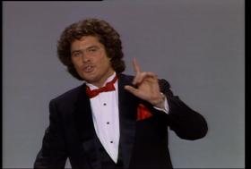

Hoff, People's Choice Awards presenter, 1984.High will only about about 36, and that will happen early in the morning. Temperatures will fall, then hold steady just below freezing for the bulk of the day.
The roads will freeze overnight into Tuesday, so delays would be reasonable. High in the mid 30s.
Delay Tuesday, 40%
Cancellation Tuesday, 15%
The second system of the week will move through beginning about 8pm Tuesday night and continuing to early Wednesday afternoon. Precipitation will begin as snow and sleet overnight, but will mix with (and change to) rain by about 7 or 8am Wednesday. So a delay is feasible, but a cancellation is less likely.
Delay Wednesday, 60%
Cancellation Wednesday, 40%
Sunny Thursday but windy and colder: high of only 31. Similar action on Friday. Saturday 2/8 looks overcast and cold (high 28), but snow-free. Sunday still looks snowy, though.
Stay tuned for ... *sighhhhh*
A quick word about the 40-inch urban legend...
Flapdoodle Gang,
So I'm tracking three storms that could bring winter weather to our area: Sunday night into Monday (likely just an inch or two, if that); Tuesday night into Wednesday (a mixed event with significant icing is looking more and more likely); and next Saturday and Sunday (a potentially larger snow event).
I'll have updated forecasting on these systems throughout the weekend.

Jörg! Keepin' it Swiss.Allow me a moment to address the recent snowpocalyptic rumors, hollered at me in the school parking lot, pinging around the hallowed halls of Mifflin, overheard in the grocery store, shared with me on Facebook, and yodeled in my general direction by an eclectic Swiss forensic accountant named Jörg.
(Alright, I made that last one up.)
One such rumor says that we are going to get 40 inches of snow next weekend. Another puts the figure at 24 inches; still another says 30 inches.
It turns out that the 40 inches figure was a cumulative one - the total precipitation expected from several storms over the course of more than a week. And it's been traced to some teenage kid who shared this map without context, causing it to go viral and everyone to go Defcon-five apeshit.
And the 24 and 30 inch totals were from one model, one run, 9 days before the event would (or would not) happen.
Here are the facts:
The snow ratios - the ratio of snowfall to liquid precipitation - for these three storms are expected to be in the range of 10:1 to 5:1. When it's colder out - as with the powdery events earlier in January - the ratios are 15:1 and even 20:1. So in order to produce 40 inches at a 5:1 snow ratio, we'd need 8 inches of rainfall. (The average total precipitation for this area in the entire month of February is about 3 inches.)
Even at a 10:1 snow ratio, we'd still need 4 inches. And the 24-inch prediction, at a 10:1 ratio, would still require 2.4 inches of liquid, which is kind of a lot.
Any forecast that purports to give snow totals 9 days from the event (or even 5 days from the event) is a steaming load of ballyhoo on a bed of fiddlesticks, festooned with glimmering twaddle.

So there you have it. No 24, no 30, no 40 inches. It's best to be prepared, to be sure. (Atlanta was warned about the snow, but ignored it. And gridlock ensued.) But in reality, these potential winter weather events are likely to produce a figure far under any of those numbers.
Stay tuned for updates!
"Finally, I can feel my face."
That is what millions in the Northeast will say on Friday as the temperature rises above freezing for the first time in about a week.
And I think the next few days will be the last of the extreme cold in this brutal, merciless, frigid, deep-bone-shuddering frost-scape of a winter. I mean, it'll still be cold. But normal cold for early February--highs in the upper 30s, lows in the lower 20s. Not Arctic Circle-type action.
Thursday 1/30 will be frigid, still, after a frigid night (down to 5 overnight). High 28, low 15.
Friday 1/31 looks mostly cloudy with a slight chance of a few snow showers. High 38, low 27.
Saturday 2/1 will again by mostly cloudy. Could be a little ice/sleet early; watch for icy patches. High 42, low 30.
Sunday 2/2 looks cloudy and breezy. Chance of a few afternoon rain showers. High 44, low 31.
Monday 2/3 looks variably cloudy and a bit colder. Flurries or snow showers possible. High 36, low 23.
Tuesday 2/4 will be sunny and uneventful. High 35, low 19.
Wednesday 2/5 brings our next chance of potentially disruptive snow. More than six days before the event, models conflict. Right now I'd make the following preliminary prediction:
30% chance of a complete miss - little or no precipitation.
20% chance of a mixed event - starting out as rain, changing to snow, accumulating 2-4 inches.
35% chance of an all snow event - accumulating 4-8 inches.
15% chance of an all snow event - accumulating 8-12 inches.
(I think that adds up to 100%. Math teachers, please check my work.)
 Thursday 2/6 looks breezy and cold with clouds and sun. High 33, low 18.
Friday 2/7 looks colder still (but again, not the breathtaking polar deathgrip of this week and early January). High 28, low 16.
Next weekend (2/8 and 2/9) still looks snowy, particularly Saturday night into Sunday. It's a long way off, though. A lot can change between now and then.
 The following week looks cold (nearly normal cold, with highs in the low to mid 30s). Looking at February 13th and 15th for some interesting weather. And when I say interesting, I mean, No, god no, not again, ugh.
Stay tuned for updates!!
In my idle traversing of the fecund underbelly of the internets, I found a website called Star Whispers that features Chinese horoscopes for celebrities. And of course, it includes material about David Hasselhoff. These are all real quotations from that website. I have not doctored them in any way.
 "David Hasselhoff is technically talented which shows both in his thinking and his activities. He loves to detangled the most diverse things with the head and the hands in order to put them back together perfectly afterwards. David Hasselhoff likes to work independently and possess a professional attitude."
- "David Hasselhoff is the bedrock of society, the foundation of any enterprise. He is an organizer and manager. David Hasselhoff's approach to life and to problems is methodical and systematic. He is a builder and a doer. David Hasselhoff turns dreams into reality." [Monsoon's note: those first two sentences are among the most profound that have ever been uttered. It is definitely fodder for a bumper sticker. Nay, a religion.]
- "David Hasselhoff is profound, does not like to reveal himself and is hard to comprehend. Therefore David Hasselhoff has only a few close friends and often feels not at par."
- "David Hasselhoff needs someone encouraging and motivating him. Sometimes David Hasselhoff seems to be a riddle. David Hasselhoff's ideas are hard to comprehend. With the money of others David Hasselhoff deals well and even increases the wealth. Not so much with his own."
- "Politics, this different kind of acting interests him and if he plunges into it it is not to play the role of an extra. His liking of glamorous appearances is part of his dynamic personality. With such a mentality David Hasselhoff will bring it to fame in any resort."
- "David Hasselhoff is always on the search for challenges and sentimental adventures. The amorous conquests can be an opportunity to verify his seductive skills - which is necessary to calm his ego -, but also is a must for his development."
I mean, it's just magnificent and endlessly fascinating. (The website, but also works for The Hoff.)
