
Nor'easter moves in; snow for some?
Brace yourselves for a lot of rain, which our area has been lacking of late. We could also see a number of problems in the area due to this storm. The specifics:
 Rain and drizzle have already begun, but the heaviest will be this evening and overnight - maybe from 5pm to 3am. We could see a couple inches of rainfall, causing urban flooding. Windy and chilly, with highs only in the lower 50s and lows in the lower 40s. The storm is hugging the coast, so the most damaging winds will be confined to coastal cities.
In western Pennsylvania (Pittsburgh and north) along with western New York, look for heavy, wet snow that will accumulate 6-8 inches - perhaps as much as a foot in some areas. And--shades of October 29, 2011--that heavy, wet snow will cause leafy tree branches to snap and result in widespread power outages that could last for days.
Monday will be cloudy, breezy and cool with a few showers possible. High will be 51 and low will be 39, but this will feel like 45 and 25 due to the wind.
Tuesday will also be cloudy, breezy and cool. Some forecasters are suggesting that lingering showers Tuesday morning could fall as wet snow. I call bullshit. No snow. High 53, low 40.
Wednesday looks milder with only light wind and some actual sunny periods. High 62, low 47.
Thursday will be variably cloudy with a passing shower or two early. High 64, low 41.
Friday will usher in what is for me ideal weather. It will be mostly sunny, breezy, and cooler. High 54, low 38 (with the wind, these will feel like 48 and 30). And this same type of action will continue on Saturday. Sunday will be a bit milder (high of 64) but still plenty of sunshine.
Next week--the one that ends April and begins May--will have a rainy, mild start. Look for clearing skies and highs approaching 80 by the end of the week (5/3 and 5/4).
Next weekend looks sunny and warm with highs in the low 80s.
The following week (5/7 through 5/11) is looking seasonably pleasant with highs in the upper 60s and low 70s.
Happy Jenkins' Ear Day!
“Fuck’s sake, Jenkins. We get it, your ear’s off and you’re bloody furious. But we were just going to sit down to lunch.”
...and also Winston Churchill Day. April 9th. The latter commemorates the day Churchill was posthumously named an honorary American citizen; the former refers to a mid-18th century war between Britain and Spain that involved British mercantilist Robert Jenkins exhibiting his ear (which had been severed by a Spaniard) before Parliament. Seriously. Look it up.
And we're in the midst of National Grilled Cheese Sandwich Month, National Pecan Month, Cranberries and Gooseberries Month, Brussels Sprouts and Cabbage Month, Tomatillo and Asian Pear Month--and National IBS (Irritable Bowel Syndrome) month. Those celebrations are at cross purposes, it would seem.
It's also International Twit Award Month (send nominations to me via email) and National STDs (Sexually Transmitted Diseases) Month (send one to me at ... never mind.)
Anywho, the weather. It's been really dry and windy over the last few days, thanks to a high pressure system squeezed in over our area. We'll see rain and chilliness over the next week, followed by a return to warmth...
Monday 4/9: We've got another Red Flag Warning for today, as extremely low relative humidity levels coupled with high winds produce ideal conditions for wildfires. Winds could gust toward 50mph. High of 63. Tonight we'll see windy conditions persist (though the wind will diminish), a continued partly cloudy skies. Low of 35.
Tuesday 4/10: Happy National Farm Animals Day! Today will be mostly cloudy, breezy, and cooler with a high of 54. A couple of stray light showers are possible. Overnight low of 44.
Wednesday 4/11: It's National Pet Day! Again, we'll see mostly cloudy skies, breezy conditions, and cooler temperatures. Scattered showers may again move through in some places, but it won't be a "washout." High 52, low 45.
Thursday 4/12: Celebrate DEAR (Drop Everything and Read) Day by walking in to a grocery store, loading up your arms full of celery and tomato soup and cat food, walking to the register, letting it all crash to the floor--then calmly take out a book, take a seat, and read. I mean, that's what I am going to do. You guys celebrate in your own ways. So the weather will be continued cool and breezy, but with more sunshine. And no rain. High 56, low 42.
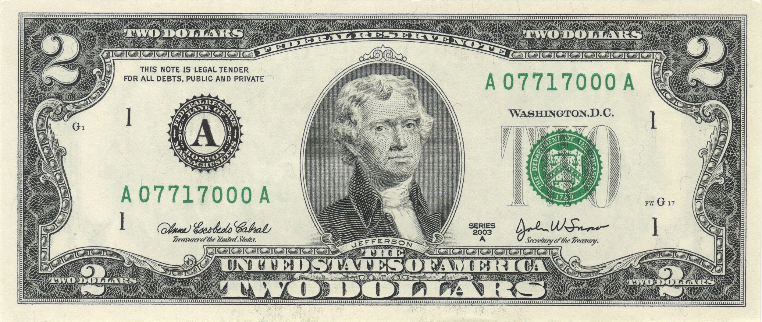
Friday 4/13: It's Thomas Jefferson Day, so go out and father a child with your -- no, nope, that's inappropriate. Better yet, buy something for $2.05 and pay with a $2 bill and a nickel, both of which feature Jefferson's likeness. And the weather will be sunny and milder. High 62, low 41.
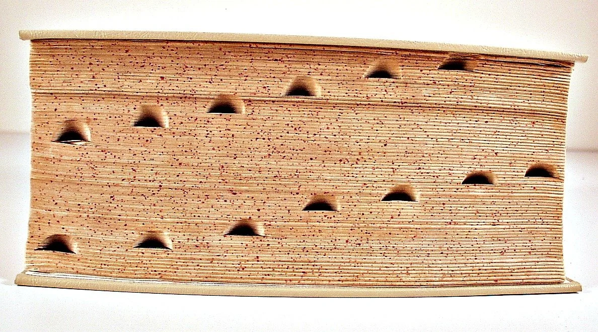
Saturday 4/14: Dictionary Day! To celebrate, go find an actual dictionary (not one on a computer or your smart phone, but an actual dictionary with pages you can flip through). Open to a random page. Close your eyes and pick a word. Use that word in conversation at least five times throughout the day. The weather will be partly sunny with a stray thunderstorm possible. Look for highs about 66 and lows in the upper 40s.
Sunday 4/15: In addition to being the traditional Income Tax Day, it's also National That Sucks Day, which seems to be an appropriate, if inelegantly stated, sentiment. Today will be warmish with a high of 69, and perhaps some a bit of a shower in the afternoon. Overnight low will be in the mid to upper 50s.
Next week: Be sure to mark the redundantly named National Haiku Poetry Day (April 17th), Husband Appreciation Day (April 20th), and, of course, Record Store Day (April 21st). Next week's weather looks unseasonably warm to start (highs in the 70s Monday through Wednesday), then after a little hiccup, we'll see even warmer temps for the end of the week. The following weekend (the 21st and 22nd) will see highs in the upper 70s with brilliant sunshine...
Near-Record Warmth, Mild Conditions Prevail
 Dear Reader,
It's been a while since I've said hello, but it's been so damned nice that there's nothing to write about. Winter weather has been missing for weeks, but the actual seasons change in a couple of days. Conditions this time of year typically have highs in the low to mid 50s and lows in the low to mid 30s, with a bit more rain than usual. Meanwhile, we're going to see a continuation of mild and dry conditions for about the next week. Here are the details...
Monday 3/19: A foggy morning gives way to partly cloudy skies. Slight chance of a shower or thunderstorm in the afternoon. High 76 (a few degrees shy of the record of 78 set in 1918). Low 53.
Tuesday 3/20: Mostly cloudy with a few isolated AM showers. High 71, low 56.
Wednesday 3/21: Mostly sunny and a bit breezy with a high of 75 and a low of 52.
Thursday 3/22: Partly to mostly sunny with highs about 81, approaching the record of 83 set in 1938. Low 53.
Friday 3/23: Clouds mixed with sunshine; an afternoon shower or thunderstorm cannot be ruled out. High 79, low 50.
The weekend: Seasonably cooler and rather windy with showers likely on Saturday afternoon, then rain likely Saturday night into Sunday morning. Highs 69 on Saturday and 56 on Sunday.
 Next week: We'll begin with a windy a cool Monday (high of 56), and we'll see highs in the mid to upper 50s to near 60 for much of the week. Look for rain on Wednesday, Thursday, and Friday.
Next weekend: Warmer (highs in the upper 60s) and nice for the last day in March and the first day in April.
Leap Day storm update
Weather-friends,
It looks as though the system is going to arrive a bit later, which is going to make a significant difference in the forecast.
Snow mixed with sleet will begin sometime 7 and 9am tomorrow, but will quickly change to plain rain as temperatures climb into the upper 30s throughout the day. Rain will taper overnight, leaving just a chance of scattered showers on Thursday. Some places will see little or no frozen precipitation at all.
A slushy coating is the most I expect from this; locations north of Reading and in higher elevations may see an inch or two of accumulation before the changeover.
I'm revising the school disruption meter for Berks to...
30% chance of delay Wednesday
15% chance of cancellation Wednesday
Stay tuned for updates when and if they become necessary.
The next (and most likely, the season's last) chance for frozen precipitation is a hit-or-miss clipper on March 5th. Thereafter, we'll see highs creep into the 60s as spring approaches...
Leap Day storm?
Many people commented that Saturday morning's brief period of snow signalled the end of this (mostly) snowless winter. Maybe, maybe not.
A storm is developing for Wednesday that may bring some wintry weather to the forecast area.
I'm keeping a close eye on this one, as the temperatures at the surface and aloft will determine what kind of precipitation--and therefore, what kinds of delays and traffic issues--we'll get.
Right now it's looking like this:
 Precipitation begins as snow around 5am Wednesday and begins to mix with and change to sleet by around 10am. The whole mess changes over to rain by early Wednesday afternoon. Rain tapers overnight into Thursday, and we could still see some drizzle or light rain showers throughout the day on Thursday.
Wednesday's high will only reach 35. Thursday's will be 40 with high winds making it feel much colder.
I expect the total accumulation of snow and sleet from this system to be an inch or two at most.
Right now I'm setting the school disruption meter for Berks at...
65% chance of delay Wednesday
30% chance of cancellation Wednesday
Friday looks partly cloudy and milder with highs in the upper 40s. Saturday looks windy with the chance for showers and a high in the mid 50s. Sunday looks partly sunny, windy and cooler with a high in the mid 40s.
On Monday 3/5 we could begin the day with some ice, so I'll keep an eye on that, too.
Stay tuned for updates as this event comes into better focus...
Wintry weather potential for the remainder of February
Is winter over? That's the question burning up the internets where meterologists (legit and otherwise) gather. It's a difficult question to answer, and a dangerous one, too. Trends point toward increasingly milder weather, and the sun angle makes accumulating snow less likely with each passing day. But we had a snowstorm in October, for frick's sake. If this winter has been anything, it's unpredictable.
The latest buzz centers on the potential for a Nor'easter on Sunday into Monday. Some forecasting models are pointing toward a blizzard with more than 18 inches of snow; others show a complete miss for our area. So what's going to happen? Here's my take on the final two weeks of February...
After an evening of scattered showers and drizzle on Tuesday night, we'll see gradual clearing on Wednesday 2/15 with a high in the low 50s. We'll see light precipitation develop overnight Wednesday into Thursday morning, and then steadier precipitation will set in for the afternoon and early evening. Temperatures will still be around freezing early Thursday morning, so we could see some icy spots develop. But the bulk of the precipitation will fall as plain rain, as Thursday afternoon temperatures will reach into the mid 40s.
Chance of Thursday school cancellation, 15%
Chance of Thursday school delay, 25%
Friday and Saturday will be partly sunny and breezy, with highs of 48 both days. Overnight lows will reach 30 each night.
Sunday will be partly cloudy and chillier with a high of only 42. I think the buzzed-about storm will miss us, so no precipitation to worry about. Monday 2/20 looks brilliantly sunny with a high remaining in the lower 40s. More of the same for Tuesday.
We'll likely see some rain on Wednesday 2/22 and Thursday 2/23, but it will be plain old rain. No wintry weather excitement here.
The final handful of days in February will be milder on the whole, with highs reaching into the 40s and 50s.
Stay tuned...
Saturday snow?
Today, the temperature will reach into the upper 40s, perhaps the low 50s, with mostly sunny skies. It will cloud up later, and a bit of rain will begin by 8pm or so. The rain will mix with, then change to, snow overnight (around midnight).
We’ll only dip below freezing as the precipitation is nearly gone. The snow will change back over to rain by mid-Saturday morning, then taper by noon. We could see scattered light snow showers on Saturday evening as well. The high temperature on Saturday will only get to about 38. Total accumulations will be just about an inch or so.
On Saturday evening, temperatures will begin to fall through the 20s and reach the teens overnight, with some wind.
Sunday morning could be a bit slippery, as afternoon highs will only reach 30 or so.
Travel will be the most treacherous late Saturday night into Sunday morning, particularly on secondary roads. Otherwise, expect just wet roads.
Monday and Tuesday will not be a cold; highs will reach near 40. Milder still on Wednesday and Thursday, which will be mostly cloudy with highs near 50.
The next threat of wintry weather is a bit of mixed precipitation Friday night 2/17 into Saturday 2/18. Otherwise, the trend is toward milder weather, and nothing much is on the horizon…
Monsoon's analysis of Wednesday's upcoming winter weather...
Monday night we’ll see temperatures drop into the upper 20s. On Tuesday, we’ll see similar conditions to today: high of 51, low of 29.
On Wednesday, a light snow event is likely. Expect light snow to begin falling by 8am, then continue intermittently—falling moderately but never heavily—through the morning. By late morning, the snow will mix with (then change to) rain, and by late afternoon some snow may mix in again. All will taper by 6 or 7pm. Temperatures will rise from freezing around 8am to the upper 30s in the afternoon.
Impacts from this storm will be minimal. Snow will mainly stick on grassy surfaces, and roadways will just be wet. There’s no a whole lot of moisture with this system, so any accumulations will be negligible.
Potential for cancellation Wednesday, 15%
Potential for early dismissal Wednesday, 30%
Potential for delayed start Thursday, 25%
Thursday will be continued seasonably cool; conditions will be breezy with a mixture of clouds and sun and a high in the mid 40s.
Friday will be much the same.
Saturday will be overcast, but nothing will materialize from this ominous cloud cover. We’ll also see colder temperatures, with a high in the low to mid 30s. Wind will make it feel below freezing.
Sunday will be sunny and windy, but continued cold. High only in the mid 30s.
There’s the potential for ice and freezing rain from Monday 2/13 into Tuesday 2/14, so stay tuned on that one.
Thereafter, we’ll see milder temperatures (highs in the 50s) and any wet weather we get will be plain rain…