
Monsoon's Monday night update: the vicissitudes this week; storm for the weekend?
Hi!
Just wanted to give you guys an update on the weather. Tomorrow morning (Tuesday 1/29) should not pose any travel problems, as temperatures will hold steady in the mid-30s (and certainly above freezing) overnight.
Showers on Wednesday followed by steadier rain (and even a thunderstorm!) later in the afternoon into the evening. High 64. Becoming quite windy on Wednesday afternoon-evening as well.
Times of sun and clouds, windy and colder on Thursday with a high of 43 that will feel like the low 30s.
Friday will be colder still with a high of 30 and a low of 20. (It will feel like the teens, though gird your loins for BC3-4 conditions.)
Saturday and Sunday look partly sunny with highs in the mid 30s. Some forecast models see a clipper system Saturday night into Sunday that could move through and give us 2-4 inches of accumulation.
(I have seen most of these systems sail north of us and/or suffer from moisture starvation, so it's not something I'm terribly alarmed about.)
Looking ahead, I see another clipper for the 5th-6th, and a potential Nor'easter for the 8th-9th.
Otherwise, not much is going on. Meteorological winter is two-thirds over and it's been pretty uneventful thus far.
As always, stay tuned for updates...
Monday's disruption potential (and beyond...)
We here at Monsoon's weather blog are following a developing system out of the midwest that could cause hazardous driving and disrupt schedules on Monday.
[Alright, the plurals there are pretentious. It should be "I am following..." since it's just me.]
Sunday will be mostly sunny with a high of about 34. Clouds will increase toward evening as the system in question approaches. Low 23.
Monday is a complicated mess. We've had very frigid air at the surface, and this system will bring in warmer air aloft. Which one wins out will determine what kind of precipitation we'll have. I'm leaning toward a colder solution (particularly for Berks and Lehigh), for a number of reasons. Here's what to expect:
 Precipitation begins as light snow around 6am Monday, when temperatures will be in the mid-20s. Snow will accumulate a half-inch to an inch before changing over to sleet and freezing rain by 9 or 10am. Precipitation will change over to "plain rain" by noon or 1pm, as temperatures climb into the mid-30s, then hold steady there. The precipitation will be mainly light, and look out for misty periods (and even some fogginess) that will reduce visibility.
Rain and drizzle continues off and on through Tuesday afternoon.
There's not a whole lot of moisture associated with this system, but it doesn't take much to produce ice-stormy conditions.
Hazards: the aforementioned snow accumulation, along with up to a fifth of an inch of ice accretion, will make the roads dangerous. Hairiest travel will be from 7am to about 11am, but use caution all day.
Scheduling disruptions: I am predicting the following...
Delay Monday, 70%
Cancellation Monday, 45%
Early dismissal Monday, 10%
Milder on Tuesday with some lingering rain or drizzle, as stated. Temperatures rise into the low 50s.
Milder still on Wednesday with some rain likely--heavy at times, particularly late--and even the potential for a rare January thunderstorm! High climbing into the lower 60s.
Thursday sees the arrival of a strong cold front, which will bring heavy winds and much colder temperatures. High 38, low 21.
Friday will be much colder and still breezy. Maybe some flurries and snow showers. The high will only be 27. The low will be 16.
Next weekend will feature variably cloudy with highs in the upper 20s.
Next week looks milder to start (high of 40 on Monday), but I'm watching several potential snow-producers on February 5th, February 7th, and February 13th. (This is also the time of year for Nor'easters to really develop, and they often do so rapidly, so stay tuned.)
Friday = bust. Sadly.
My good people,
If I had a nickel for every colleague who has asked me today and yesterday whether we're still "on" for a snow day on Friday, I'd be a wealthy man indeed. Actually, they didn't so much ask as they pleaded, insisting on a day off with a desperation that bordered on mania. I would like nothing more than to confirm that we're headed for a snow day on Friday--a good, old-fashioned, snowing-when-we-wake-up, no-doubt-about-it, early-call, hunker-in snow day.
But no.
Here's what we'll have instead.
Wednesday night: Diminishing wind. Bitter cold. Low 9. BC4.
Thursday: Very cold and windy. Highs in the low to mid 20s, lows in the low teens. Wind chills in the single digits. BC4.
Friday: Really cold again. Light snow showers and flurries developing by late morning; light snow in the afternoon and evening (1pm to 10pm). Total accumulation 1-2 inches. High 25, low 17.
![]() A word about school closing percentages: One of my distinguished peers--let's call him "Shat Flavis" to protect his identity--castigated me over my last percentage call of 40%. "Come on, man. Give us 5% or 90%," he bloviated, implying that my middle-ground call was safe, was a cop-out--was unmanly. I will not be goaded into impetuousity, however, by a diminutive volleyball coach. I am a grown man who enjoys certain fragranced soaps, has an inexplicable fixation on David Hasselhoff, and forecasts the weather reasonably. Recognize that shit.
A word about school closing percentages: One of my distinguished peers--let's call him "Shat Flavis" to protect his identity--castigated me over my last percentage call of 40%. "Come on, man. Give us 5% or 90%," he bloviated, implying that my middle-ground call was safe, was a cop-out--was unmanly. I will not be goaded into impetuousity, however, by a diminutive volleyball coach. I am a grown man who enjoys certain fragranced soaps, has an inexplicable fixation on David Hasselhoff, and forecasts the weather reasonably. Recognize that shit.
So here are my predictions about closings:
Friday closure, 15%
Friday delay, 10%
Friday early dismissal, 30%
Saturday: Partly sunny, windy and cold. High in the mid 20s, with wind chills in the teens. BC4.
Sunday: High of about freezing, but it'll feel quite a bit milder than these frigid-assed days. BC2-3.
Next week: Getting milder. Highs in the 40s by Tuesday. Some precipitation by midweek, but that looks like rain at this point.
Next good chance of snow: Sunday 2/3 to Monday 2/4; Thursday 2/7 to Friday 2/8; Monday 2/11 to Tuesday 2/12. Of course, don't count on any of those. Meteorological winter is nearly two-thirds over, and we're running out of chances for good snow.
Stay tuned for updates!
Quick update: Monday night's clipper, Profound balls-coldness, and Friday snow?
Here's what to expect over the next week:
Monday 1/21: Overcast with a few light snow showers in the afternoon and evening. This clipper system is fairly moisture-starved, so I don't see more than a dusting to a quarter-inch from this. High 33, low 17. Breezy, especially at night, so we'll see wind chills at or below zero. BC4-5. Ouch.
Tuesday 1/22: Arctic air moves in, for reals. Breezy, too--especially early. Partly sunny. High 24, low 11. BC4-5 all damn day.

The flag of Uruguay. It is a happy, happy sun.Wednesday 1/23: The coldest day of the winter. High 20, low 8. A solid BC4 all day. Mainly cloudy with some breaks of sunshine.
Thursday 1/24: Cold, again. But a bit less so. High 26, low 15. It'll be like Uruguay in July, as the old saying goes. (It's not a saying at all. But it should be, since the two words rhyme, and I imagine it's soupily hot there all the time. Or maybe it's not where I think it is. Near the equator, right? Someone enlighten me.)
Friday 1/25: Snow and sleet are likely, from Thursday overnight into Friday evening. It's about 100 hours away, so my forecast can (and likely will) change between now and then. But for now, the most likely scenario is 4-6 inches of accumulation (mostly snow) and travel hazards. And, potentially, school closures. High 33, low 21.
The weekend: Plenty of sunshine, but cold. Highs in the mid 20s, lows in the mid teens. Windy as balls on Sunday too. (Question: should I devise a balls-windiness scale as well? A balls-hotness scale?)
Stay tuned for updates...
It's balls to the wall time!!
Astoundingly, the origin of the phrase cited above has nothing to do with the gonads, though most people who hear it assume it to be a testicular reference. In fact, it originates from aviation: the throttle handles have "balls" on top of them, so when a pilot pushes them to the wall, it's full speed ahead. (There is some disagreement as to its origin, with some positing that the phrase originates from submarining or even railroading. But all are in agreement that the phrase's derivation has nothing to do with the bollocks.)
So, the weather. It's going to get cold. (Well, colder.) Here's what to expect:
Becoming sunnier on Saturday with a windy afternoon. Temperatures will reach the mid 40s, but will feel more like the mid 30s. Same deal on Sunday, with a bit more wind.
 Not literally true. But let's face it: it might as well be.A strong arctic blast moves in on Monday, bringing with it the chance of flurries and snow showers, though I don’t see the potential for measurable accumulation. High Monday 28, low 17. (Wind chills in the low 20s during the day and the low teens overnight. BC3, perhaps reaching BC4.)
Tuesday will be even colder—and brisk, too. High 24, low 15. Wind chills will be in the lower teens (daytime) and about zero (overnight). BC4, perhaps reaching BC5. When it’s BC5, when you say, “It’s cold as balls,” the words freeze into a solid block immediately after leaving your mouth. So don’t even bother.
Wednesday will be partly sunny, breezy and cold. High 26 (wind chill low teens), low 18 (wind chill upper single digits). BC3-4
Thursday looks partly sunny and less windily frigid. High 32, low 22. BC2 in general.
Overcast and quite windy on Friday with highs in the upper 30s and lows in the mid 20s. BC2.
Saturday 1/26/13 brings the next potential of wintry weather. Right now I’d say we’re in for a 6-8 inch snow accumulation, but I will provide updates next week as the event comes into clearer focus. Highs around freezing. BC3-4.
Sunday looks sunny, clear, and colder and strong winds. Highs in the mid 20s (wind chills in the low to mid teens) and lows in the mid teens (wind chills in the upper single digits). BC4.
The following week (January 28th to February 1st) looks promising if you’re starved for winter weather: snow and ice are possible Tuesday the 29th into Thursday the 31st. And maybe something on the following weekend (2/2 and 2/3).
Stay tuned for updates...
Overnight snow / sleet / rain event
My day began in the following manner:
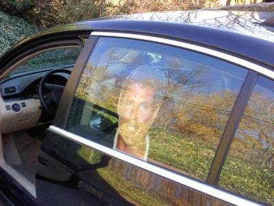
The Hasselhoff head in question. Here it is pictured on the driver's side; I have since moved it to the passenger side because every time Mrs. Monsoon parked to my left in the driveway, she would be startled by the Hoff face staring at her, causing her to utter something like, "Gaaa! God damn it, it's Hasselhoff."I was stopped at the light at 5th and Washington Streets on my way to take The Bunk to day care (don't judge) and then go to work. I had just bade auf wiedersehen to my sweet wife, whose drive to work partially parallels mine.
[I pause here to remind you that my rear passenger side window is adorned with a life-size Hasselhoff head.]
A cab then pulled up alongside me to the right, and the driver rolled down his window, smiling broadly.
"That's the Hoff, huh?"
"You know it!"
"Aw, nice dog, there. [in Bunk's direction:] Mwah!"

"Hahaaauh. Thanks!"
And then he was gone. And my day was made.
So what can we expect from this storm tonight?
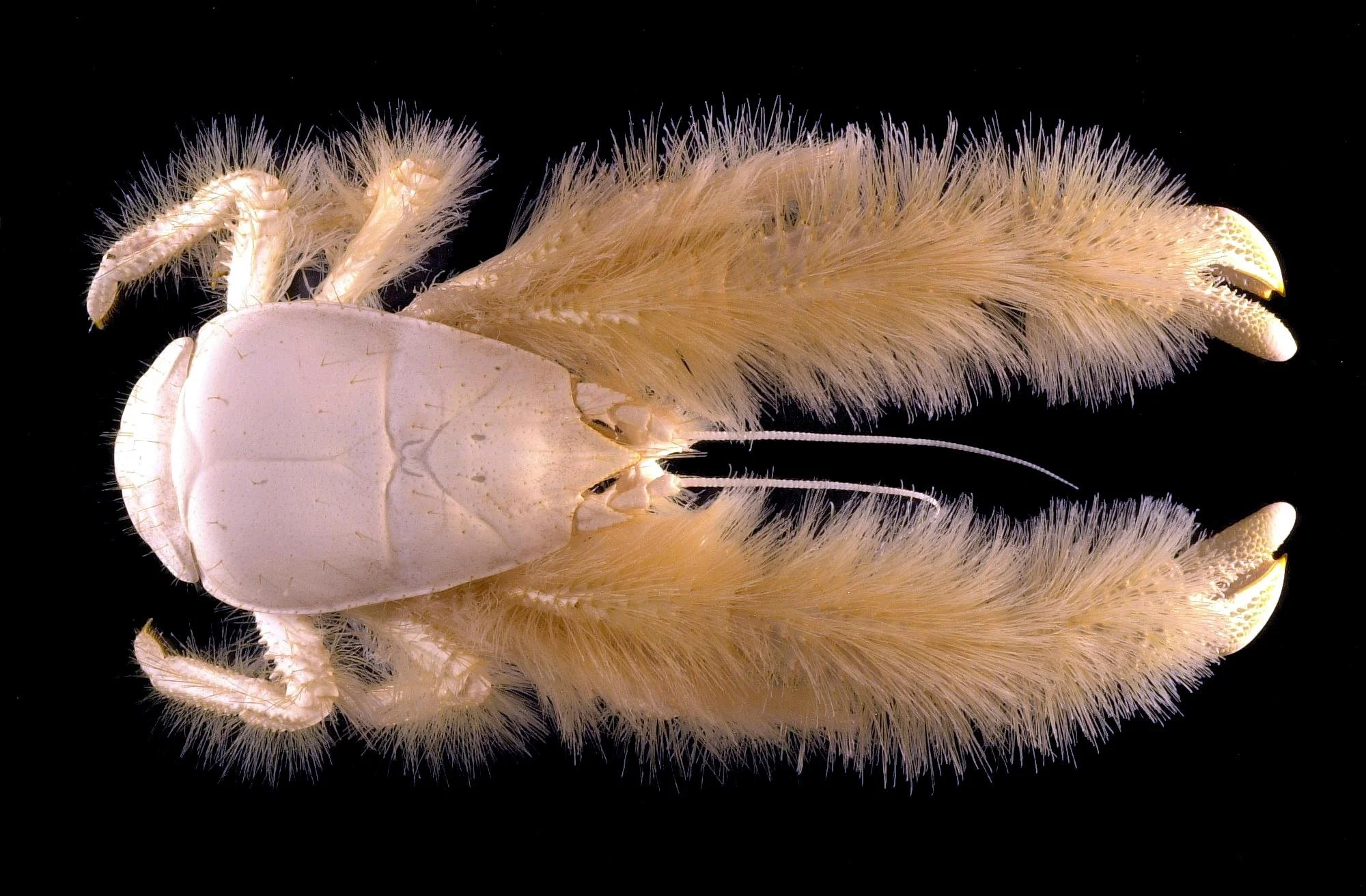
It's the Yeti crab, nicknamed the Hoff Crab by the crew who found it (on account of its evocation of Hasselhoff's hairy chest). It's found in the extreme southern Atlantic. Seriously. The Hoff Crab.Snow and sleet begin by 8 or 9 tonight, continuing and mixing overnight. The extent to which they mix (and the extent to which rain mixes in) depends on your location. In Berks County and points north and east, we're looking at a mostly snow and sleet event. In the immediate suburbs of Philadelphia and points south, it'll be mainly rain. Location will be important with this one.
During tomorrow morning's rush hour it'll still be sleety, but then it mixes with (then changes to) rain, ending by around noon.
Total accumulations of snow and sleet will be in the 1-3 inches range (and likely on the low end of that). Temperatures will hold fairly steady in the low to mid 30s, so we could see some deterioration in travel conditions for the early morning rush.
Probability of delay for Wednesday: 40%
Probability of cancellation for Wednesday: 15%
Stay tuned for updates as they become necessary this evening!
Milder than normal, then normal, then cold, then BC5.
Hi!
I have a forecast for you. If you have not yet done so, please go and "like" my Monsoon Martin facebook page. It's easy, and it's free, and it will help more people enjoy all of this splendor.
Monday 1/14 begins with fog, which will dissipate toward late morning. Temperatures will get into the mid 50s. Maybe a few peeks of sun in the afternoon, but otherwise, overcast and rainy late. We may see a bit of sleet mixed in, but I don’t see any real potential for winter weather. Breezy and turning cold later: low of 34.
Cloudy on Tuesday with a slight chance of snow showers, then rain showers. Generally free of precipitation. High 42, low 30.
 David Hasselhoff, star of stage, screen, and song, rides a tiny motorbike.Wednesday will feature typical January grey, but some periods of sunshine are possible. High 45, low 28.
More of the same on Thursday: high 44, low 25.
Friday will be breezy and sunny with colder temperatures. High 38, low 22.
Next weekend will be overcast with seasonable temperatures. High both days in the low 40s; lows in the low 20s.
Next week begins with colder temperatures, then much colder temperatures. Snow showers (or possibly more) on Monday 1/21; highs in the mid 30s. Highs on Tuesday and Wednesday will only get into the mid 20s, with lows in the teens. We’ll see windy conditions—especially on Tuesday—sending us into BC5 territory for the first time this season. (Protect all your vulnerable bits!)
Next really good chance of snow is Wednesday 1/23 to Thursday 1/24.
We’re getting into a colder pattern here, folks. I know you’ve heard this before, but I shit you not, it’s going to be cold.
January ends cold—and possibly snowy, anywhere in the 1/30-2/1 window.
As always, stay tuned for updates!
I've got a short one for you.
Brief forecast, friends.
Temperatures will be above-normal for about the next 10 days, but the last half of January is colder and potentially snowy.
This week: Plenty of sunshine generally. Highs in the low 40s on Monday, rising to 50 by Thursday. Lows will be in the mid 20s to begin the week; around freezing by Thursday. Pretty windy on Wednesday. Friday looks rainy with temperatures in the mid to upper 40s.
 This weekend: Overcast and mild with some showers likely on Saturday. Highs in the lower 50s, lows around 40.
Next week: Monday the 14th will be overcast, chilly, and rainy. High in the lower 40s. We'll see partly cloudy conditions and similar temperatures on Tuesday and Wednesday. The next really good chance of snow is Thursday the 17th into Friday the 18th. We'll see highs only in the mid 30s on each of those days.
Next weekend: An ice or snow storm is possible on Saturday the 19th. So that'll be fun! Sunday looks clearer and still cold, with highs in the mid 30s.
The rest of the month: Shit gets real. Highs below freezing, lows in the teens, BC4 conditions dominant. Major storm possible on the 24th or 25th.
Stay tuned for updates!